Precious Memories: The West Coast Trail
Happy Birthday Kari
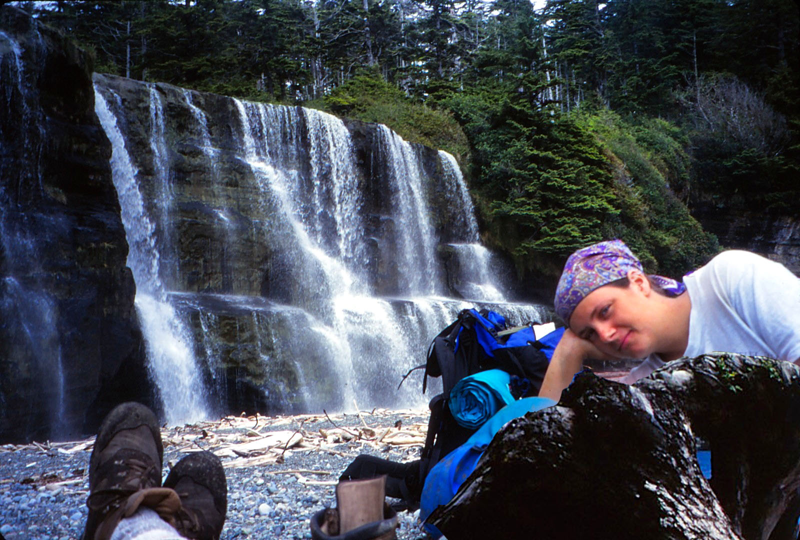
The beautiful Tsusiat Falls where father and daughter took a well-deserved rest.
All that is left of the father is his boots and socks. “Yaa! But you’ve made it over halfway Dad. That’s good isn’t it?” Guess who helped him?
January 1, 2018 (337) (April 17, 387)
Dear Kari,
It’s hard to believe twenty years have slipped by since we completed that magical eight-day trek on the West Coast Trail with David and Jenn. What inspired me to prepare the following slide show and write this post was finding that old slide tray tucked away in one of the storage boxes. It brought back so many fond memories for me and I bet it will do the same for the three of you. As I was writing this post I spoke several times to David, as well as to your Uncle Barry and Auntie Agate.
Before getting into the details of the trek, take a few moments and enjoy the slides as they slip by. I tried to find music that expresses the love a Dad has for his children and, as well, displays the sense of pride that comes from having one of your children lovingly act as a mentor and guide in taking on a difficult challenge. The three songs were selected after pouring through dozens of father/daughter/son lists posted on the web.
Precious Memories, J.J. Cale
When You Need Me, Bruce Springsteen
Wildflowers, Tom Petty
The photos in this slideshow have also been uploaded link to the
McNeill Life Stories Facebook Page
Opportunities arise but once.
Life provides many opportunities for adventure, but when one declines an opportunity for any reason, it is most often gone forever. Having achieved a Golden Age in retirement and understanding this, when our oldest daughter Kari phoned and ask if I might like to join her and a cousin from Montreal, David McGregor and his friend, Jenn D’Aoust, in challenging the West Coast Trail, the answer came without a second thought, “yes”. Sure I had concerns about my ability to tackle that particular trail, but if my daughter thought I could do it, who was I to argue?
Also, it gave me comfort knowing she was an experienced backpacker, held an Industrial First Aid Certificate (just in case pops packed it in), had tackled that trail twice before and, being an extraordinary backcountry trekker had at one time considered taking up a career in the emerging field of Eco-Tourism.
When this opportunity arose I was nearly two years into retirement, in fair shape and while I hadn’t recently attempted any long-distance wilderness hiking, I remember Kari’s comforting words: “Don’t worry Dad, you can do this and, besides, I’ve got your back.” Hmmm! Of course, it was a done deal as when someone, particularly one of your children, offers to share a moment like this, It must be taken as the memories will last for the rest of your life.A few days later with my rental gear collected (Kari had her own special stuff) and the basement ankle-deep in meal packs (breakfast, lunch, and dinner duly numbered by day), we began carefully packing those bags (D1 food at the top, D8 at the bottom). Everything was packed in the order of need from hourly (water/snacks), to less frequent (spar bandages, socks, etc.)
Of course, Kari had all manner of lightweight camping gear (stove, utensils, pots, tent, ground mats, etc.) as well as insulated, easy dry clothing so essential for the West Coast even in mid-summer. All I had to do was follow her directions and fill in the missing parts for my kit.
A day later, David and Jenn arrived from Montreal and shortly after that we hit the road. Lynn and Sean (he was then eight), dropped us at the trail Head in Port Renfrew and after a bite to eat they bid farewell and began the three and one-hour hour winding drive back to Victoria. We would be on the trail soon and I was nervous wondering if Kari may have dumped her Dad in over his head.
The Wild, Wonderful and Dangerous West Coast Trail
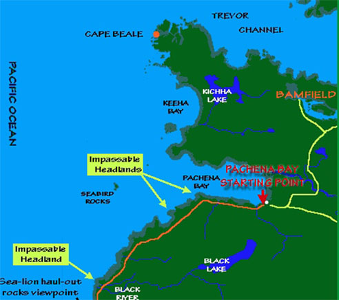
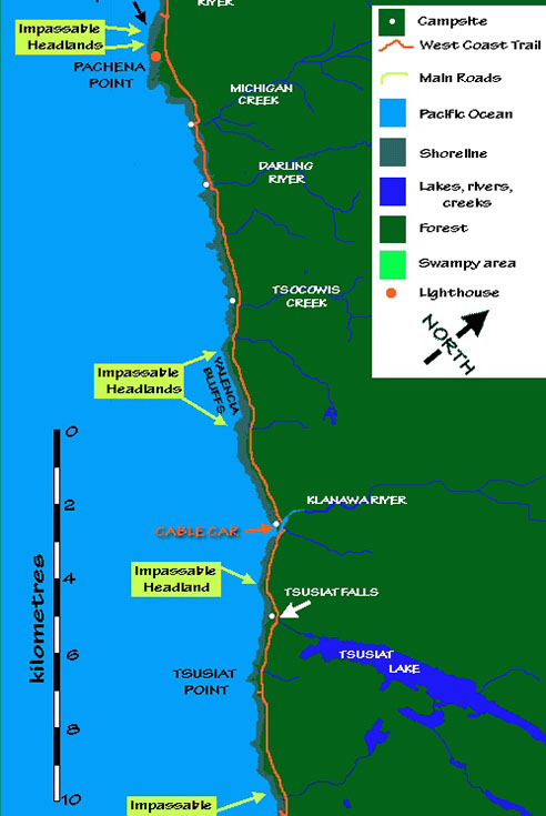
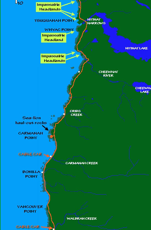
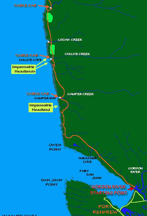
Map (Web Source): Link here for an excellent trek planning and longitudinal map provided on the West Coast Trail, Rules and Guidebook Website. A sectional copy of their map is included in the footer of this post for quick reference.
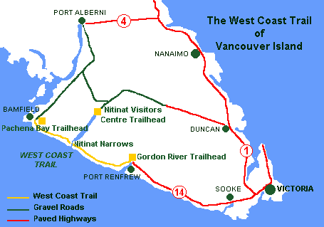
Over the decades, the West Coast Trail trail has worked its way into the Top 10 hiking trails in the world and while personal interest often dictates which trail is the best, the WTC is not one to be trifled with particularly if the weather turns ugly. If your first question about the trail is “what should I pack”, you had better consider one that is less demanding or get an experienced guide like Kari to keep you focussed and safe.
In the future, I will post a story about that young woman’s survival trek over the Golden Hinde, 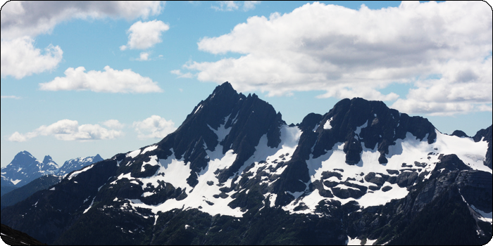 Vancouver Island’s highest peak in Strathcona Park. Nothing special you say? Well, consider this it was completed over five days in the dead of winter and the group only carried basic survival gear with minimal rations. (Link to Route)
Photo (Web Source). The Golden Hinde, Vancouver Island’s highest peak at 2200 meters.
While the WCT is listed at 79 km, that distance does not take into account the dozens of challenges that must be faced along the route. While most hikers prefer seven to nine days, experienced hikers making a dash to the finish, could probably complete in three or four days. At the time of our departure, a half dozen young Canadian Military recruits entering on the same day as our group, intended to complete in just over two days.
While some drive north and hike south, entering the trail at the south-west end provides an opportunity to visit the extraordinary display of sea life and rock formations at the Botanical Beach Provincial Park, a world-renowned sea life sanctuary best viewed at low tide.
As weather along the coast can turn on a dime even in summer, the number of days taken to complete a leisurely transit could easily wind up taking an extra couple of days if the weather turned ugly or low tides were missed. Speaking of tides, to enjoy the best the trail has to offer, a tide chart is essential in order stick close to the ocean and to experience each new vista as it opens around the next headland. The face one has to work extremely hard on this trail only adds to the pleasure.
As it turned out, we were among the lucky groups who experienced exceptional weather for our full transit and while morning fog was not unusual, by ten or eleven, it was shirtsleeves and shorts particularly when climbing and descending ladders, mud bogging and stump hopping in the rain forest. While the temperates immediately along the coast and in the rain forest usually sits about 10 or 15 degrees below that inland temperature, that is actually a blessing when trudging along with a forty-pound pack in July and August.
Taking on Challenges one at a time
Following is just a few of the challenges that must be faced (the following photos are among those posted McNeill Life Stories FB Page. (double click to open here)
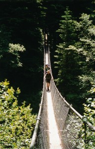 Cable Cars and Suspension Bridges: 5 cable cars and a half dozen suspension bridges span the five rivers along the trail that are situated in deep gorges. While the rivers are relatively quiet in July and August, in the fall and winder they become raging torrents and even in the summer, if there happen to be heavy storms in the area, they can quickly become impassible by foot.
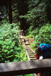
Ladders, Ladders, Ladders: I have no idea how many ladders there are on the West Coast Trail, but counted by separate, platform sections, they must number in the hundreds. Also, some of these ladders are in poor repair with missing rungs and broken supports. After going down 100-150 meters at an 80 or 90% slope, you can walk for ten minutes on flat ground, then begin climbing that 100-150 meters out of the Gorge. A couple of laters seem to stretch 30 meters straight up.
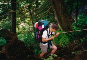 Rope Ties: On lesser slopes, say 60 or 70%, rope ties are often provided as in loose soil with few roots for support even in a canopy of trees, it would be nearly impossible to make headway without ropes. Also, it does not take many days on the trail to realize that climbing is much easier than descending, as on ascent it’s possible to keep a low centre of gravity when carrying a 40 or 50-pound pack, whereas on the descent it is difficult to keep balance in order to get a firm foothold.
Carved Cedar Log Stairs and Deadfalls: To assist in preserving the ecosystem, deadfalls that angle up steep banks have had steps cut in surface to assist hikers. Where deadfalls are held high and cover heavy undergrowth, the top side is often flattened to provide some semblance of footing. These hiker assists are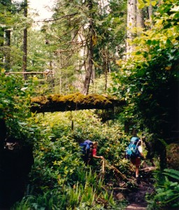 extremely treacherous as they are often covered with a slimy moss that leaves a hiker one step away from tumbling 10 feet into a mud-filled quagmire or disappearing in three-meter deep undergrowth. (Note: The fallen tree above our heads (r) was likely used at one time used to cross this mud-filled depression)
While Parks Canada employees work to maintain the trails, it must be very difficult to keep ahead of the slash and blowdowns that collect after each storm. After hurricane-force winds hit the area in 2007, the trail had to be closed for several days while park crews cleared several blockages.
Wooden walk-ways (some broken and in poor repair) also help preserve the fragile ecosystem of the area. As you will note in a few photo’s deadfalls have often been flattened with a chain saw, but, again, a covering of damp, slippery moss makes for a treacherous passage. In many other areas, the trail is covered with blowdowns, slash and flood wash that forward progress is slowed to a snail’s pace.
Blocked headlands and heavy swells: While walking on the ocean’s edge is glorious even in bad 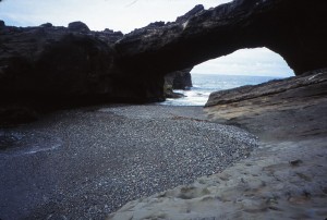 weather, hikers must remain acutely attuned to tidal changes and giant ocean swells. When distracted by the amazing scenery, a hiker may suddenly realize the tide has sneaked in to cut off and advance or retreat.
Photo: During a storm or high tide, this headland would be impassible as off the right the hiker is faced with an almost sheer rock wall.
There are emergency exits marked with orange cones, but taking these exits likely means a hard climb and some heavy bushwhacking to get back to the main trail. Whenever possible hikers will track several kilometers to safety rather than going off-trail in the rain forest where making progress is a painful process.
A hidden danger also exists after periods of heavy storms out in mid-Pacific. Large rouge swells can continue for several days and when they suddenly break on the shore can push the water 5 or 10 meters above normal. The unwary could be sitting enjoy lunch on a rock face 5 meters above the tide line and suddenly the water could be washing over your picnic table. Over the years, more than a few hikers have lost their lives after being washed away in the frigid waters of the Pacific Northwest.
Mud bogging. In several areas of deep forest, the main trail has broken down because of heavy traffic. Trying to avoid slogging through sometimes knee-deep mud is impossible as the hiker could spend hours trying to pick their way around the edge form log to log, The time taken wouldn’t be worth the effort, so most just march on through, then wash and dry their boots, socks and pants at the end of the day.
Loose sand and rock: While walking on table rock is pure joy, except in moss-covered sloping areas, when a long stretch of sand or loose rock is encountered, the going is much more difficult than mud bogging.
Surge Channels: Even at low tide, constant Pacific swell action can push a lot of water several meters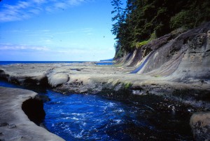 up from the low tide line. When crossing these surge channels it is necessary to time to figure out when the swell action will be at a low point and then scramble across.
Photo: It must have taken us the better part of an hour to navigate this surge channel. In the end, it was David who managed to get a rope to the other side and that saved us from having to backtrack several kilometres.
If the channel depression happens to be one or two meters deep, it is not just a simple matter of climbing down and then back out as the sides are often extremely smooth and the base is covered with slippery moss.
Photos in the slide show (and on FB) demonstrate the method we used to cross one particularly deep channel. Note: if you were not tethered to a rope and happened to get caught in a surge you easily find yourself in a life-threatening situation as you were washed out to sea.
Distractions and Injuries
The cumulative effect of the above barriers, especially in poor weather, can easily add what might be the equivalent of 40 – 50 km kilometers to the total trek. When planning and wanting to include ample time to explore, consider 10-12 km. per day as the crow flies. That might be 15-20 km. in actual distance hiked between point A and point B and even that doesn’t count the time taken to explore at various scenic locations.
Because cell phone reception was then and probably still is, very poor, injured hikers who are incapacitated may have to wait two or three days for emergency extraction depending on the weather. While only a small percentage of those who tackle the trail require rescue, on or two out of a hundred still keep our Search and Rescue people busy. When hiking in the off-season, October – March, the waiting time could be much longer. That means companions on the trail may need to attend to a serious injury or another medical difficulty as 600-800 people tackle the train each year. Having a skilled first aider in your group is a wise decision.
Precious Memories
Reflections of our West Coast Trail trek:
Racing the Incoming Tide: At one headland (photo above left), the passage is narrowed an area below a rock bridge. We arrived late and the tide and wave action had already partially blocked the passage. When swells came the water could quickly rise to waist-deep. By timing it just right we could run around the end and down the safety of the next beach, but the time frame left no margin for error. I went first Kari followed immediately by Kari. David and Jenn would wait for the next opening.
As soon as we reached safety I heard Kari use the ‘f’ word for the first time on the trek and in frustration, she used it three times in quick succession “f” “f” “f”. “My goodness what happened honey?” In her rush to get around in that slippery sand and rocky headland, she had dropped a new camera belonging to her baby sister. When the wave receded, I rushed back and found it, but even after washing it in freshwater at the next creek, it seemed that no amount of resuscitation likely to revive it. It would be best to peacefully bury it in the sand where it lost its camera life.
Bears and Slugs: Bear warnings are often posted along the trail and camping in specific areas may be prohibited. While bear attacks are infrequent, all campers must take care to protect food and gear from intrusions during the night. We were never bothered, but others along the trail made sightings and a few had even lost their food supplies simply because they were less than careful.
As for slugs, take a look at the photos in the Slideshow and on FB. Those are small slugs as hose suckers can reach 25 cm. and weigh upwards of 115 grams. You really don’t want to sleep with your mouth open or you could end up with full protein meal before breakfast even started. Did you know that if you touch them they can stick to your finger and can suck a pint of blood before you could say ‘crap, that’s one big slug attached to my leg.” Really? Hmm (Pacific Banana Slug)
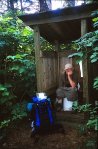 Garbage and Toilets: Garbage in garbage out. Hikers are expected to practice ‘no trace’ and one member of our party who shall remain nameless (Kari was her name), insisted on burning all traces of toilet paper when trailside toilets were not available. We finally convinced her that just digging a little hole in the moss and burying the paper along with the tiny droppings would serve the same purpose.
(Photo Left) This is one of the few formal toilets along the trail and it sits right on the edge of a well-beaten path. As other hikers pass by, greetings are usually exchanged and some might even stop to chat for a moment if the strong odor doesn’t drive them away…
I did not include the two photos of my using trailside and beachside toilets in the slideshow, but have included them on the FB Page series.
Headache: One the second day out the ache in my head and shoulders was constant and even after taking three or four extra-strength Tylenol and consuming plenty of water, it remained. We first we attributed it to carry that 45-pound pack, but even after the kids each took five pounds, it continued. It promised to be a difficult trip, but by the early morning of the third day finally subsided, then disappeared. The kids piled my stuff (and some of theirs) in my backpack and we were off again. The likely cause – withdrawal from coffee.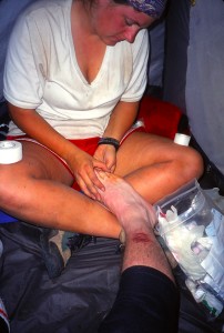
Wet Feet: Over the first day or two, we diligently removed our boots and socks and carried them across the many shallow creeks and flooded ocean areas, but because it took so long, by the end of the second day we just trudged on through. With good boots and wool socks, it made little difference. Putting on wet stuff in the morning was a different story so we tried to dry our socks at night. This caused a problem for David as he always put them to close and was running short of socks (see a photo posted below).
Blisters and Barnacles: While I suffered more from blisters and scrapes, Kari was an amazing nurse. She tenderly covered my blisters with Mole Skin (freshly trapped and skinned) and after arriving home the skin over those blisters was still intact and no raw wound ever appeared. (Photo right with a war wound on my shin)
Neither was Kari immune from aches and pains. An old injury to her right knew leftover from her field hockey days caused her a great deal of pain particularly when walking in loose sand and rocks. Each morning and a couple of times during the day, she had to tighten the stretch bandage to keep that trick knee in place.
 About three days in and after sliding down the side of surge channel (several photos in the slideshow and posted on FB), I noticed a stinging in my right buttocks. A couple of days later I downed my pants and Kari checked it things out. With a pair of tweezers, she removed a large piece that had broken off a barnacle and imbedded itself nicely in my bum.
Search for Fresh Water: It is not possible to carry sufficient water for the trip so each day it was necessary to search out clean streams and then to treat the water with iodine before drinking. Boiling is OK, but it takes more and uses up a lot of extra fuel for no good reason. Each day near the end of our trek we would begin the search and fill up everything could before we pitched camp.
Watching Kari on every ladder: Those dozens of steep ladders mentioned earlier, caused me a great deal of stress not so much for myself (it was just hard work going up and down), but because I was fearful for Kari. She is shorter than I and has to work harder to get from one rung to the next. Also, she was carrying a good 50 pounds in her backpack and those stairs were often so steep, a person body was being pulled away from the ladder rather than pushing into it. Whenever she encountered a point with a missing step, she almost had jumped to make the next step. I always followed her and each time I watched her jump, my heart was in my mouth.
Tsusiat Falls: This is easily one of the most scenic and delightful falls on the West Coast Trail. It was still in full flow in July so you can imagine what it would be like in early spring after those heavy winter rains. It was at Tsusiat Falls they have a toilet that is open to the magnificent Pacific Ocean. Oh, and on leaving the falls, you need to climb about 40 meters back up to the trail.
Canadian Forces Two Day, Overnight Run: You may have noticed a half dozen Canadian soldiers spread throughout the slideshow. They were dressed immaculately in highly polished boots to match the rest of their gear when they left for their two-day run to Pachena Bay. I would love to have loved to capture a few photos when they arrived. We only saw them at the beginning, but I sprinkled their photos through the slideshow.
Final Comment
Because various web sites provide exceptionally good information about hiking the West Coast Trail (a few links are provided below) this post has mainly covered the challenges we faced and humorous anecdotes that occurred along the way. Perhaps after reading the post, Kari, David, and Jenn may wish to jog my memory with a few anecdotes of their own. Just shoot me a message kid and I will add.
End of the Trail – Pachena Bay, just south of Bamfield
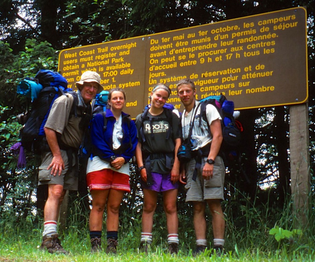
Job Complete. Standing at the Northwest Trail Head at Pachena Bay
West Coast Trail Map
(971)
Tags: Michigan Creek, Darling River, Nitnat Lake, Gordon Bay Staging Ground, David McGregor, Jenn D’Aoust, West Coast Trail, Port Renfrew, Bamfield, Pachena Bay Trailhead, Jordon River Trailhead, Botanical Beach Provincial Park, Tsusait Falls, Kari Walker McNeill, Harold McNeill, Lynn McNeill, Sean McNeill
Trackback from your site.

Comments (1)
Thanks for a wonderful trip down memory lane Dad!!! That was an amazing trip and I am so glad that we had the opportunity to share that experience together!
❤️